"From Ground Data to Green Clearances — Your Trusted Partner in Mining and Surveying."

 Home
Home
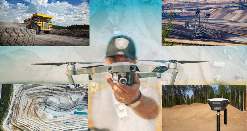
At SV Enviro Labs And Research Pvt. Ltd., we specialize in delivering end-to-end Mining and Land Survey Services to support industries, infrastructure developers & government agencies in executing their projects with precision, compliance, and environmental responsibility. We cover everything from obtaining statutory clearances and preparing mine plans to conducting EIA, EMP & continuous environmental monitoring. We ensure that every mining operation meets regulatory standards while promoting sustainable and responsible resource management.
Backed by a team of skilled surveyors and environmental experts & equipped with the latest instrumentation like Trimble GPS, Garmin eTrex, DGPS, and UAVs, we deliver reliable data & documentation that form the foundation for sound engineering, environmental compliance & project planning. Whether you’re initiating a new mining project or require precise land data for infrastructure development, our integrated solutions help ensure your project is technically sound, environmentally sustainable, and legally secure.

"From Ground Data to Green Clearances — Your Trusted Partner in Mining and Surveying."
 Our Mining related Services
 Assistance in obtaining comprehensive environmental clearances and mining permissions from relevant authorities.
Development of detailed mine plans, including layout and resource management strategies, to ensure efficient extraction.
Preparation of closure plans as per mining regulations to ensure safe, eco-friendly closure of mining activities.
Conducting Environmental Impact Assessments and preparing Environmental Management Plans for mining projects to evaluate and minimize ecological impacts.
Regular monitoring of air, water, noise, and soil in and around mining areas to ensure environmental safety and regulatory compliance.
Guidance and support in securing forest and wildlife clearances as per government and statutory norms.
Detailed mapping of land features and elevations using GPS, Total Station, and drone technology for planning and engineering purposes.
Classification and mapping of land use patterns to support environmental planning and impact studies.
Identification and demarcation of legal land boundaries to assist in property ownership, acquisition, and documentation.
Creation of high-accuracy digital maps and geospatial analysis for infrastructure development and environmental assessment.
Terrain modeling and slope evaluation to assess the suitability of a site for construction, roads, and industrial use.